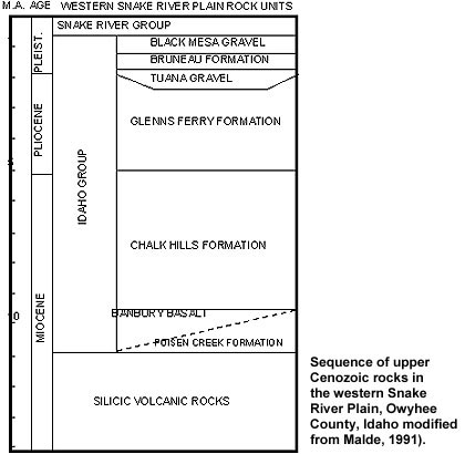
Labels:text | screenshot | font | diagram | parallel | line | number OCR: M.A. AGE WESTERN SNAKE RIVER PLAIN ROCK UNITS SNAKE RIVER GROUP BLACK MESA GRAVEL BRUNE AU FORMATION TUANA GRAVEL PLEIST. GLENNS FERRY FORMATION PLIOCENE IDAHO GROUP CHALK HILLS FORMATION ET"ABURY BASALT 0 L - - - POISEN CREEK FORMATION MIOCENE Sequence of upper Cenozoic rocks in SILICIC VOLCANIC ROCKS the western Snake River Plain, Owyhee County, Idaho modified from Malde, 1991).